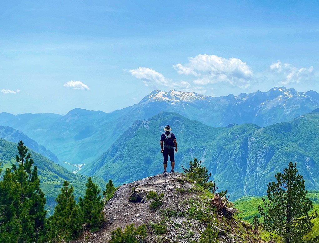
Stunning landscapes abound, but there are moments when a dramatic peak or majestic vista can leave me speechless. Hiking in northern Albania offers such experiences. Although hiking in southern Albania is certainly worth the trek, we found the north to be even more captivating.
The Accursed Mountains (cursed mountains) is the portion of the Alps that extends into northern Albania. One of the various legends claims a devil escaped from hell and caused havoc to create the jagged peaks, but when we climbed these stunning peaks, they looked more like heaven to me.
For a map of places covered in these two posts and descriptions of hikes south of Tirana, see Hiking Southern Albania.
Tirana: More Than Just a City
Tirana is not only a fantastic hiking destination but also a photogenic city. Our full article on Tirana provides detailed information about hiking opportunities in the area, along with a brief history of the city’s triumph over tyranny.
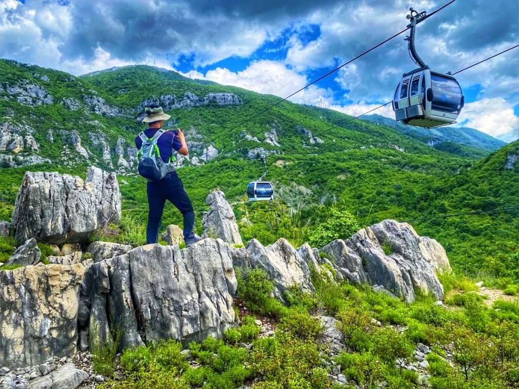
No matter where you are lodging in the city, the local city bus, costing less than $1 per ride, makes it easy to reach the trailhead near the Dajti Ekspres cable cars. We recommend downloading Organic Maps (a free app) and reading our information about the dead-end trail to make your day hiking more enjoyable.
Krujë: A Fortress of History
Like many towns in Albania, a castle fortress perched high on a rocky outcrop dominates the Krujë valley. Though smaller than the fortress in Gjirokastër, it still evokes a regal prominence. This castle is the home of Albania’s national hero, Skanderbeg, the legendary warrior who defended Albania against the Ottoman Empire.
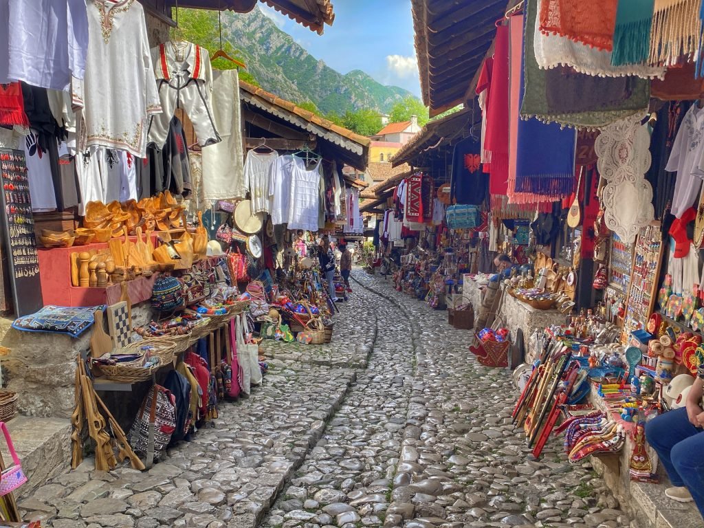
Beneath the castle lies the Old Bazaar, filled with traditional Albanian crafts such as handmade rugs, ceramics, silver jewelry, and local delicacies. The bazaar’s cobblestone streets and wooden buildings create a picturesque setting reminiscent of a bygone era.
The Perfect Villa with a View
Upon checking into our accommodation, Garden Villa Guni, we stepped onto the porch and admired the view of the valley extending to the Adriatic Sea. I asked Trin if we should extend our stay for a week. After checking the weather and seeing a storm front coming through the following week, we kept our original dates to complete our hikes in Theth (our big hiking destination) before the storm arrived.
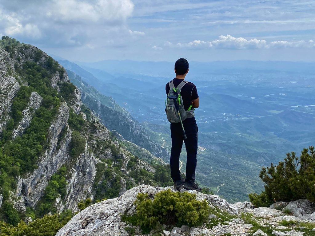
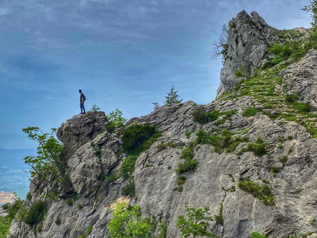
Trail Up a Rock Face
The following morning, we packed our day pack with lunch and water and began the path just a few meters from our villa. The trail went straight up the mountain, which our villa clung to. Looking up at the castle far above, I saw only cliff faces and wondered how this trail would get us there safely. Initially, the trail was not encouraging, but it soon became a well-maintained path that appeared to be centuries old. Still, I didn’t fully trust it. I wondered at what point the trail would disappear or become a scary scramble up a rocky ledge.
I needn’t have been concerned. The trail led us safely to the top, offering stunning views the entire way.
The Cave and Place of Sacrifice
At the top, a set of stairs led down to a tiny prayer room in the crevice of the rock face. We considered whether it was worth the extra steps down and back up to see the tiny room, but went anyway. I’m glad we did. It turned out to be much more than just a prayer room. A cave next to it led further down into a large room with a stone bed, clothes hanging to dry, and a locked door leading deeper into the cave. We heard dripping beyond the door but couldn’t see around it.
A small porch on a landing leading to the prayer room smelled rancid, laced with the scent of copper, the smell of blood. Looking up, we saw flesh hooks hanging from a hefty bar along the top of the porch. This must have been a place of sacrifice.
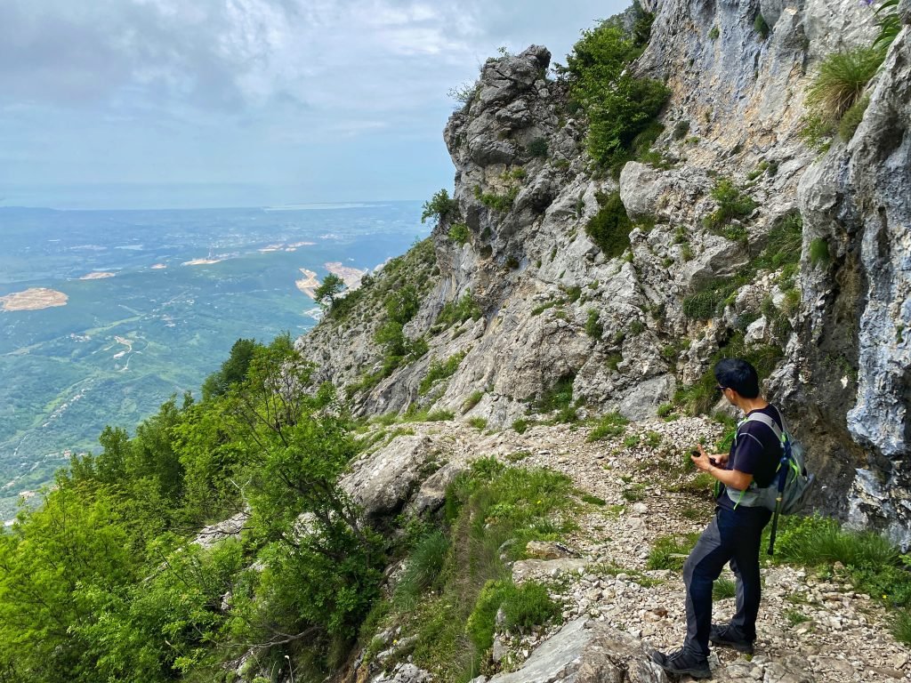
After eating our lunch at the top of the mountain above Krujë, we opted to take a much longer route back down via the road on the backside of the mountain, providing views of the valleys beyond Krujë and a gentler descent.
Starting from our villa, the climb to the top was 1.3 miles (2 kilometers) with an ascent of about 600 feet (183 meters). Our return trip following the road into the next valley and around the mountain was 4 miles (6.5 kilometers).

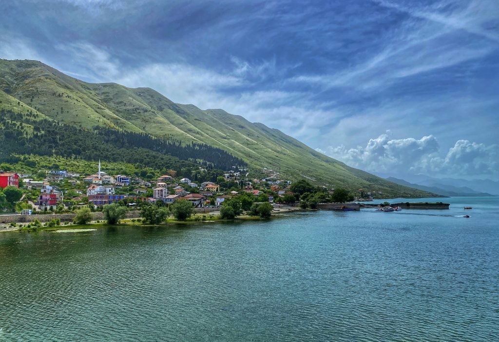
Shkodër
Shkodër sits on the edge of Lake Shkodër, renowned for its clear water. It also served as a gateway for our journey to and from Theth. Since we booked the same accommodations for both before and after our trip to Theth, we could leave Trin’s backpack behind, packed with everything we could do without for a few days.
Rozafa Castle overlooks Shkodër from a small hill to the west. Unlike the dramatic fortresses in other Albanian cities and towns, this one didn’t seem particularly remarkable. We were more interested in exploring the Lake.
Our lodging offered bicycles for rent, which we considered using to ride along the shore of Lake Shkoder. Ultimately, we walked instead. Big mistake! There was no shade for the entire walk. By the time we reached our planned turnaround spot, we were melting, and decided to walk up to the next town and take the bus back.
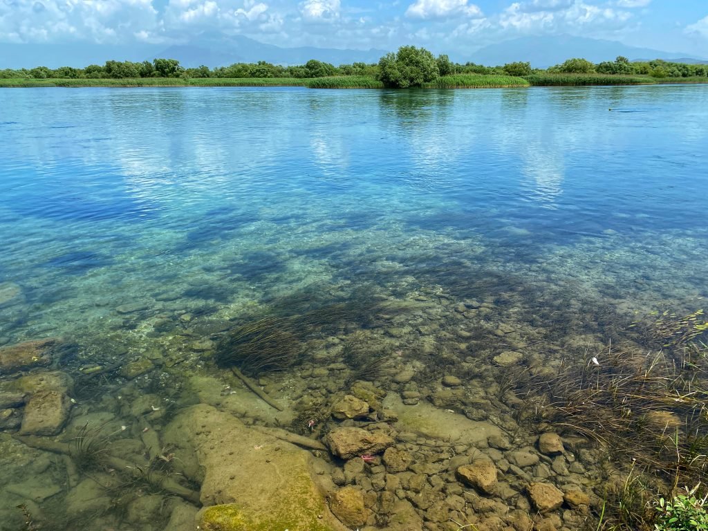
However, we just missed the last bus! Before walking back, we needed to cool down. Climbing over a rail, we followed a footpath that we hoped would lead to the water’s edge. To our surprise, we found about five older men sitting under the brush in their Speedo-like swimwear, chatting the day away. This seemed to be the local hangout and access point to the swim hole. They waved a friendly hello.
Trin joined them, swimming in his boxers, while I swam fully clothed. It was so refreshing. We drip-dried for a while on the shore before putting our shoes back on and heading home. The swim was just what we needed for the long walk back.
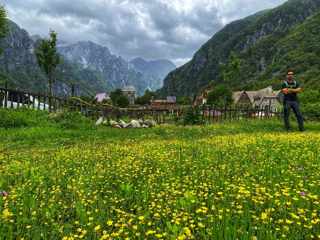
Theth: Into the Heart of the Accursed Mountains
Early in the morning, a van picked us up outside our lodging in Shkodër to take us into the heart of the Accursed Mountains. As we climbed through the mountains, I started chatting with some of the other passengers. The two guys next to me were from Algeria but living in Paris; they planned to camp in Theth and hike over the pass to Valbone. Peter, sitting directly in front of me, planned to hike to the Blue Eye from Theth and then over the pass the following day.
We talked and snapped pictures as the mountains became more dramatic. At the Bajraktari Viewpoint, the driver pulled in so we could all admire the dramatic landscape. Trin asked Peter if he had considered hiking to the Blue Eye from there. Peter perked up and asked if it was possible. We showed him the trail on the map but cautioned that we knew nothing about it, just that it was on the map. He seemed keen to take the trail, so I suggested he ask the driver about trail conditions.
Map of Trails
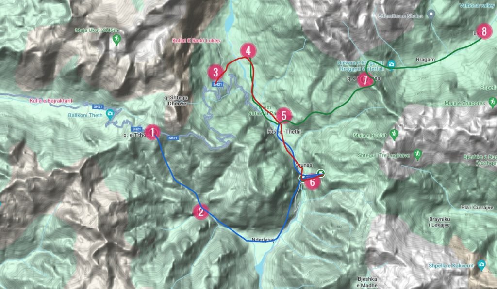
1. Bajraktari Viewpoint, and start of trail (shown in blue) to the Blue Eye and onward to Theth. 2. The Blue Eye.
3. Drop off point for Okel and trail head (shown in red) into the north end of Theth and onward to the waterfalls. 4. Our beautiful lodging
5. Theth 6. Canyons and Waterfalls
7. Valbona Pass 8. Valbona
Green trail is from our lodging/Theth to Valbona Pass and onward to Valbona
Note: These trails are not available on Google Maps. We suggest downloading local maps from Organic Maps and use the Outdoor setting.
We drove away, leaving Peter behind. He mentioned he didn’t have any food and asked if there was a place to get some near the bottom. As we drove away, I grew concerned; I couldn’t see any observable trail into the valley—it looked like a sheer drop. I wished we had given him some of our food, but would he have wanted a half-eaten byrek?
The Path to Okel
The road snaked further into the mountains. As we descended towards Theth, the driver pointed to a sign with an arrow to Okel, asking if we wanted to get out there. Trin quickly checked the map and said yes. We said goodbye to everyone in the van, grabbed our bag, and started down the trail. This drop-off point placed us above our lodging and saved us a kilometer of walking. Continuing to Theth would have left us with an uphill climb. The views of the valley from this trail were stunning. We arrived at our lodging early enough to leave behind our pack and hike to a few waterfalls and the canyon.
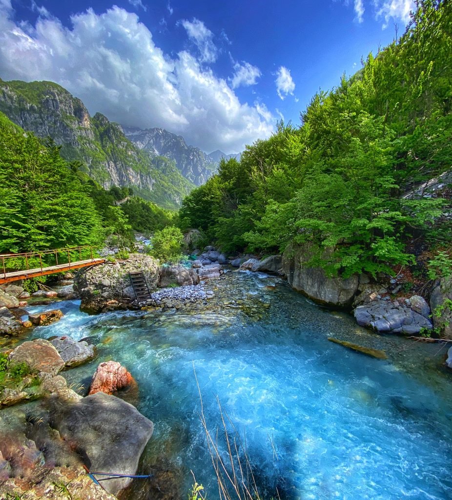
The canyon is a narrow passage through karst cliffs where the river rushes through, creating a dramatic scene. A bridge above the canyon offers a stunning viewpoint, allowing us to marvel at the vibrant blue water surging far below.
Upon reaching the large waterfall, we found a big rock to sit on and eat our lunch. The sound of water crashing into its deep blue pool was mesmerizing. Suddenly, Trin exclaimed, “There’s Peter!” Peter had made it down the valley to the Blue Eye and was now heading to Theth. We chatted for a bit, and I was thrilled to hear that he loved the trail.
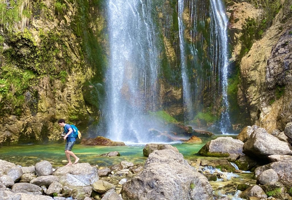
Before leaving the waterfall, Trin logged onto the Wi-Fi hotspot located next to the falls – I kid you not, in the middle of nowhere. Peter was just as flabbergasted about the hotspot. Trin contacted our host to let her know what we wanted to order for dinner and approximately what time we would be back.
Stats on Theth to the Waterfalls and Canyons
The hike from our lodging to the canyons and waterfalls was around 10.5 miles (17 kilometers) and 420 feet of elevation gain.
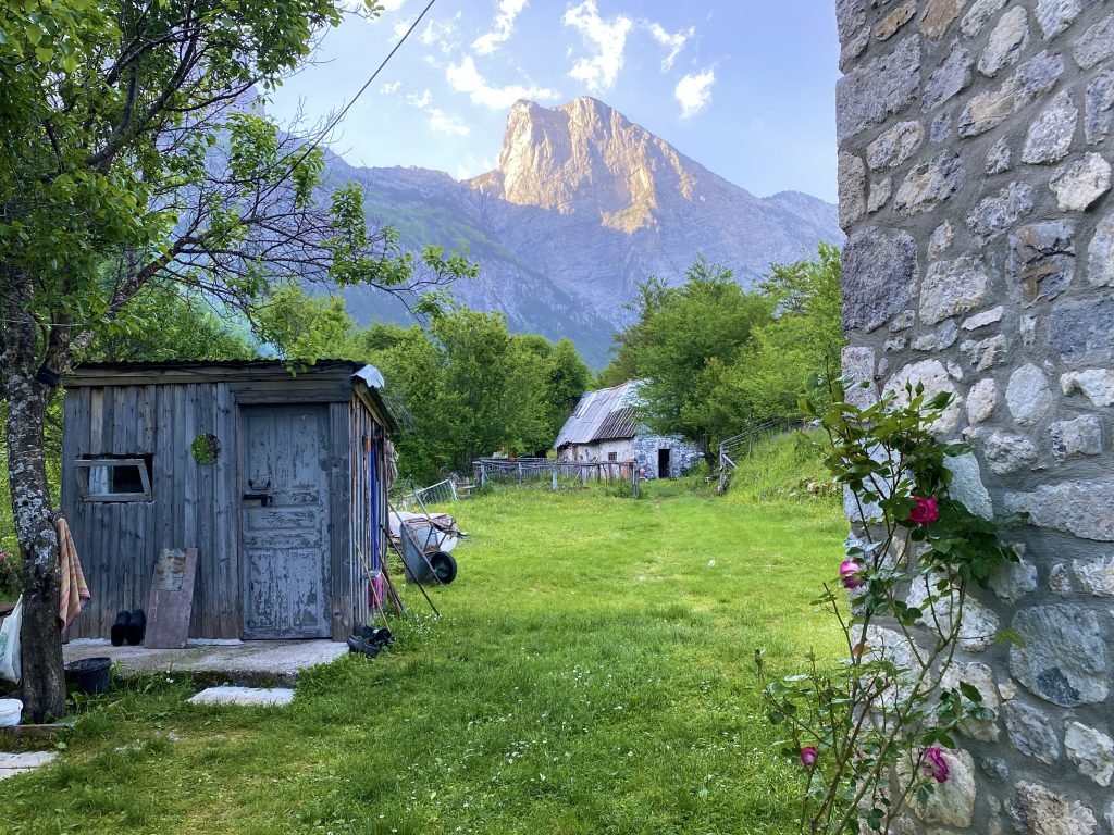
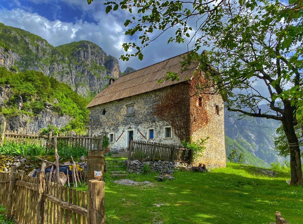
Lodging in Theth: An Experience
On our way back to the lodging, we passed gardens, cows, and pigs. Sheep grazed in a field while chickens pecked through the grass for bugs. The mountains rose majestically around us, and a crystal-clear stream ran through the fertile valley. Our lodging was in a beautiful stone home, with breakfast included. All the food came from the land, and the eggs had the dark yellow yolks of healthy, naturally fed chickens. The family made the butter and cheese. We brought tortilla wraps, peanut butter and jam from Shkodër so we could make our own lunch but ordered dinner at our lodging. It was delicious, fresh, and plentiful. The family was kind and hospitable, ensuring our stay was comfortable.
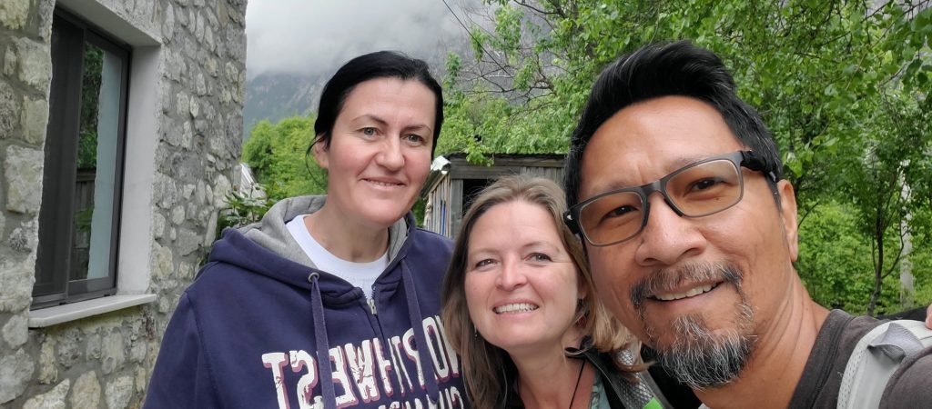
The other rooms upstairs were occupied by two other couples we met on our first evening. One couple, Mark & Mirjam known as ThePedalists on Instagram, are pedaling their bikes from the UK to Turkey; Mark is from the UK and Mirjam from Germany. Their journey is really interesting and inspiring to follow. The other couple, a Brit and a Slovak, were hiking through the Balkan peaks. We spent the evening talking about travel and experiences, laughing and enjoying the company.
Valbona Pass
Hydration
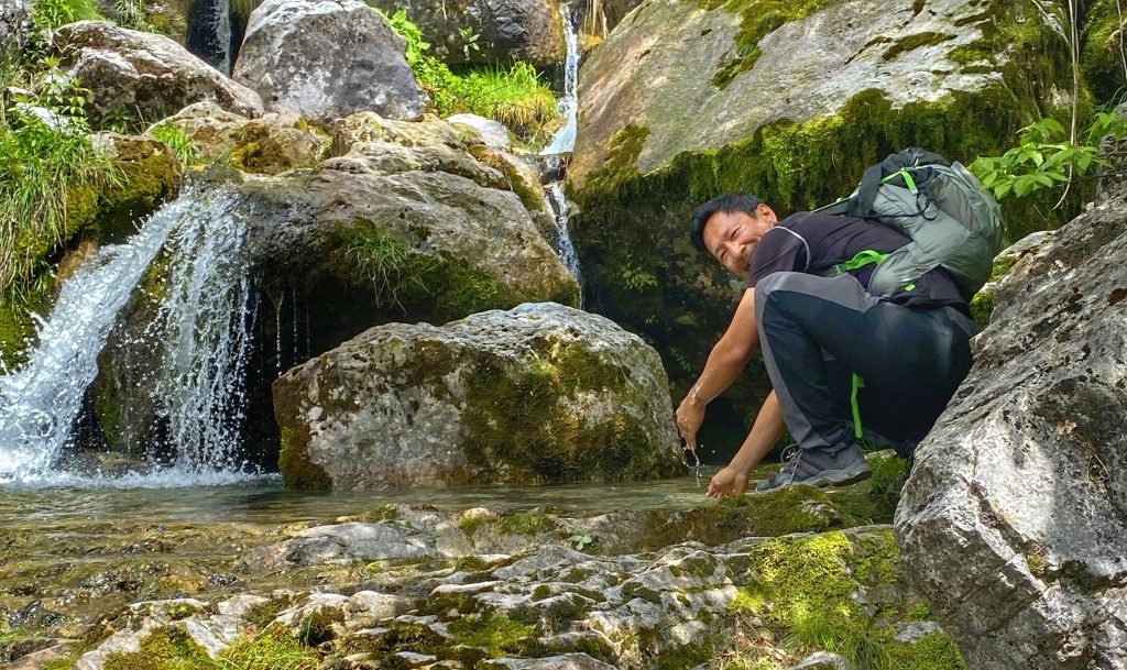
The following morning, we packed a lunch and filled a one-liter Nalgene bottle with water, tucking our water filter next to it. The trail to Valbona Pass crosses two streams of clear water where we could refill our bottle. We took a break at each stream, drinking our fill of the cold, refreshing water and refilling our bottle. The water looked pristine, but animals use the stream as well, urinating, pooping, and sometimes dying in it. Taking a brief break to filter the water easily avoids viruses and bacteria. The water sources were plentiful enough to keep us hydrated for the entire hike without having to carry too much.
The Journey
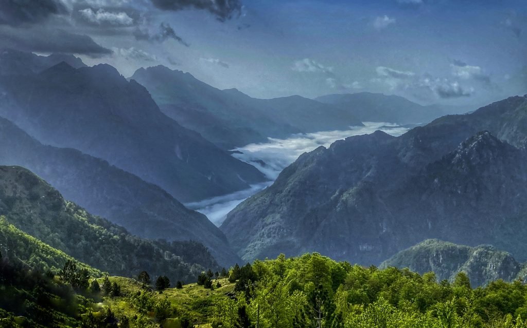
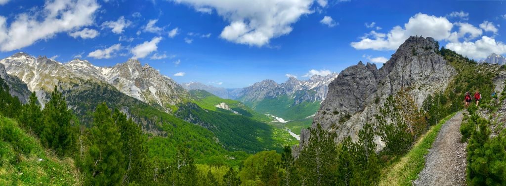
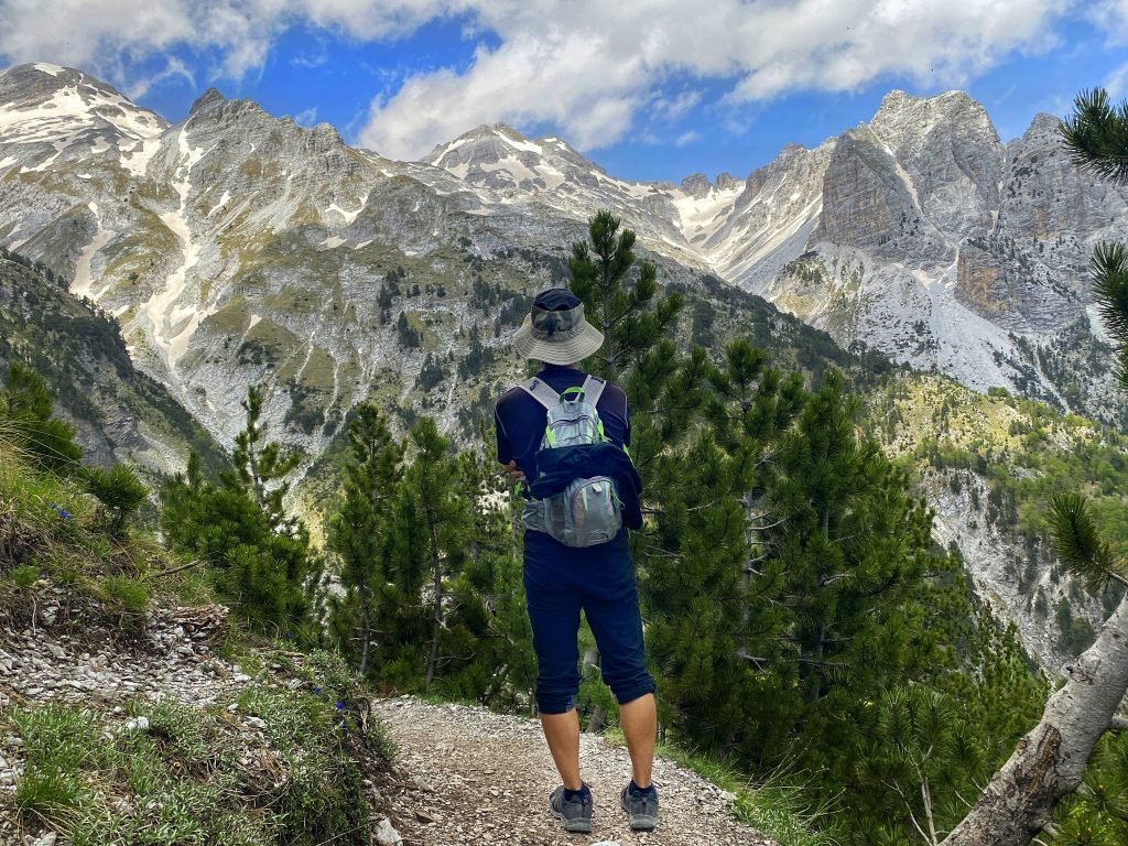
The entire journey up to the pass offers viewpoints over the Accursed Mountains. Sections of the trail are steep and exposed, while others go through quiet, wooded areas, providing a serene reprieve from the intense sunshine.
Upon reaching the pass, we walked further down the trail to get a better view of the Valbona Valley. Snow-capped mountains adorned the dramatic landscape. It was the perfect place to find a rock to perch on and eat our lunch.
It’s Peter!
Just as we were about to eat, Peter showed up again. Is it my guilt about not giving him food earlier that he always seems to show up at lunchtime? But there is no way he planned that, just a funny coincidence. On our way back to Theth, we ran into the couple doing the Peaks hike and the two guys from Algeria from the van, all on their way to Valbona. It was nice to see everyone on their journey.
That night, a major rainstorm with thunder rolled in, the storm we narrowly avoided by not extending our time in Krujë. I hoped all our new friends found good shelter along the way. The hike from our lodging to the pass (and a little beyond) and back was 13.1 miles (21.1 kilometers) with an elevation gain of 1,110 feet. The path can be quite steep, so our hiking sticks were very useful.
What is your favorite?
Our review of Southern Albania and this post about Northern Albania include all our destinations within the country. Which destination is your favorite? If you’ve been to Albania and have a favorite spot not on this list, let us know.
Such beautiful country!
It is, and the water is so crystal clear ❤️
Wow, what a great read. And the pictures you take are absolutely stunning – amazing photography. Hope you guys are keeping well in Sweden 🙂 love, M&M x
Thank you Mark! Your trek is inspiring. I love following your journey as well. https://www.instagram.com/thepedalists/