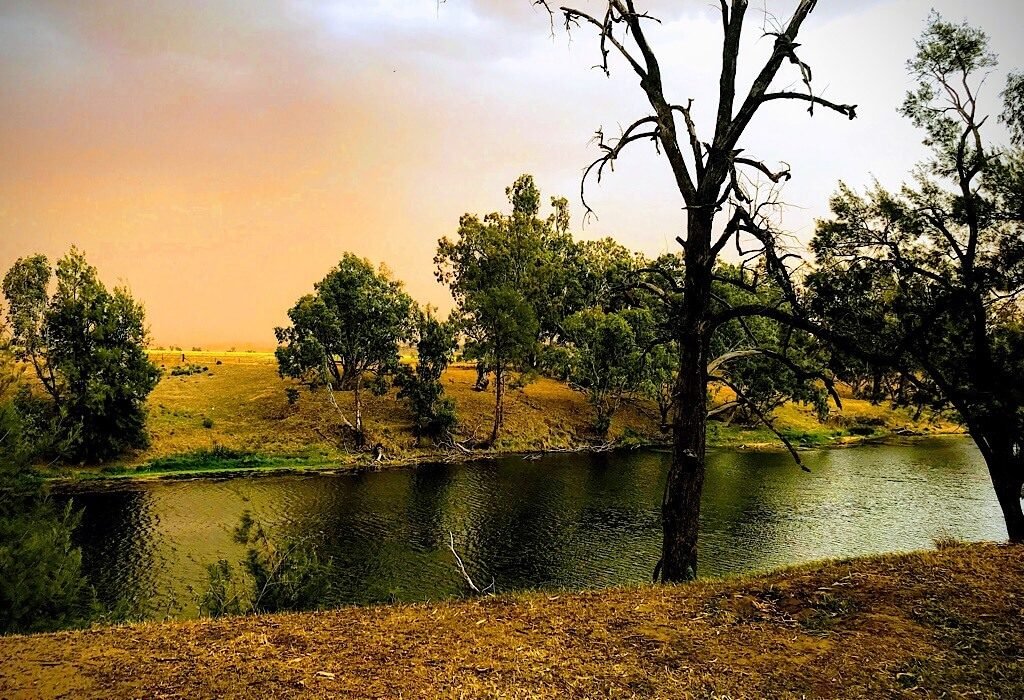
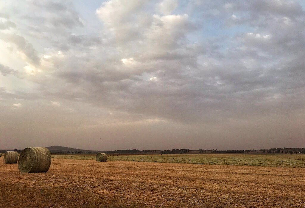
The sky is yellow with dust and the flies pester every living thing. A tractor sits idle on a barren field just on the other side of the river, one of the few here in NSW that we have seen with actual flowing water. Many of the streams and rivers are recognized only by their long winding impression in the ground, a path that once flowed with liquid life.
The Kuckaboro announces the approaching dusk as if all is well in their world while a Magpie sits only a few feet away staring at me expecting bread. The gusty wind blows away the heat of the day and makes everything feel right in my world as well.
Even with the vast plains turned pale golden parched from the long day of sun and the Cockatoo screaming bloody murder, the raw beauty of Australia persists.
See also how Australia responds to drought.
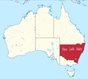
New South Wales, Australia
Online research is great, but I was feeling a little overwhelmed with the options in New South Wales. This Australian state has more than 780 National parks and reserves. I thought that stopping at a few information centers would help us decide our path. I wanted to hear personal experiences from a ranger.
“If you had a month to spend in NSW, which parks would you go to?” I asked the ranger behind the desk at Ku-Ring-Gai Chase NP.
“Oh, um,” he stood there with a baffled look for a beat. “Well, they are all pretty special,” he said as he pulled out a map. He began to point at all the dots reiterating the summary written by the indicated number.
He wanted to help, he was polite, but we let another customer jump in and then after walking around the store, we slipped out the door.
It seems that every information center only has information on their specific town or region. We would need to take one area at a time, just as if they were each their own country. Compared to South America some of these Australian states are the size of some of the South America Countries themselves.
Since most of the Outback NSW and Murray Riverina parks require 4WD to access them we will focus our current travels on the coastal and country regions.
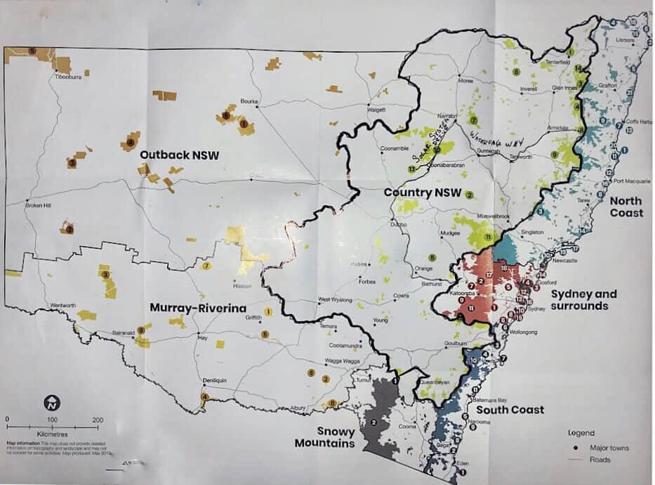
Country New South Wales (NSW)
Waterfall Way
Heading inland from Coffs Harbour we followed the Waterfall Way into the country region of NSW. It is a scenic route peppered with cliffs that used to be waterfalls and canyons where water once raged through. Most of them are now dry due to the drought, but the canyons are still impressive. Waterfall Way extends from Dorrigo to Armidale. The further inland we traveled, the less water we found.
Crystal Showers
Dorrigo National Park is a rain-forest with a beautiful array of trees including the grass trees that I am completely enamored with along with abundant wildlife. The trails gently wind through the Gondwana Rainforest. They are mostly paved to prevent erosion. I love that the parks here in Australia are cared for and preserved so they can be enjoyed by many more people to come.
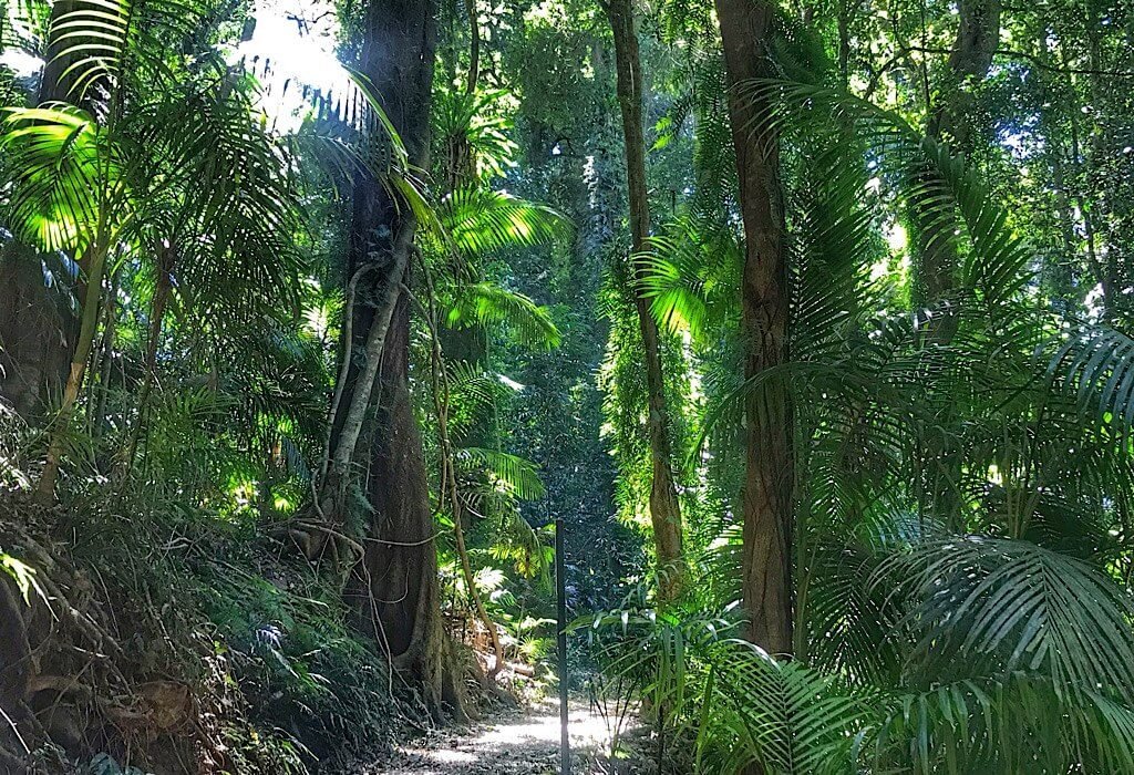
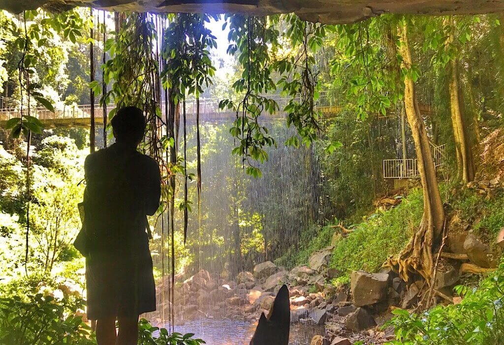
The Wonga walk descends deep into the glade and leads hikers to the Crystal Showers waterfall. Thankfully there was still a little bit of water dripping down the rocks keeping the vines a vibrant green. We walked under the waterfall and looked out through the cool drops of water.
Before leaving we asked the rangers about the other parks from here to Kaputar. Fires have been out of control this spring, some in this area and quite a few north of us in Queensland. She looked them up online and assured us that they were all open.
We filled our water tanks here knowing we were headed into more severe drought and we don’t want to use up their precious resources.
Camping in the Little Styx
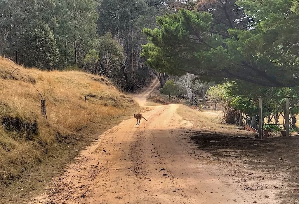
Heading further west we stopped in the Styx River State Forest to park for the night just outside the New England national park. We pulled out our awning and strung up our clothesline to hand a few hand-washed clothes that we washed earlier that day. Then we sat in our chairs to watch the kangaroo in the dry field beside us as the sun sets.
In the morning we drove 5 kilometers into the New England National Park up the gravel mountain road to the lookouts and walking paths.
At Point Lookout, we gazed over the mountain range. In the distance, we could see smoke rising and a yellowish haze hung over the horizon to the west. The forests are burning and the lack of rain that has made kindling of the forest has them blazing. This year is a record year for fires this early in the spring.
Weeping Rock
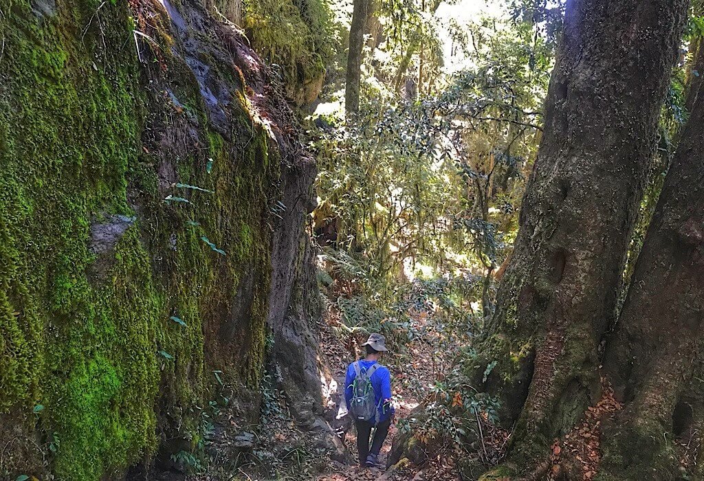
The Eagles Nest walking track is steep and winds down the cliff edge just below Point Lookout. We climbed down the southeast side where trace amounts of water still drip from the cliff. We stopped to listen. Above us, the rocks glistened with moisture.
We spotted an opening in the cliffs above and wondered if they were deep caves and if anyone had explored them. Then we heard what sounded like snores from a large creature echoing down. It was probably just frogs, but they do make a racket for such small creatures.
Some of the flora and fauna in this park have also been found in fossil form in Antarctica.
Remnants of a Raging River
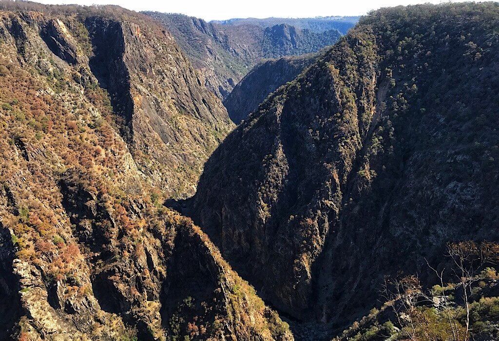
Our next stop along Waterfall Way was the Oxley Wild Rivers, National Park. We stopped here to see the canyon in which the Wollomombi and Chandler rivers fall creating two massive waterfalls just after heavy rains. The drop of the Wollomombi falls is over 260 meters but if the cascades at the top are included the Wollomombi falls constitute a 424-meter waterfall – if it has been raining.
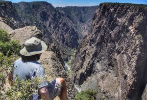
The canyon here has black rocks lining a steep narrow gorge, reminding us of the Black Canyon of the Gunnison in Colorado, USA. There once was a massive waterfall on the far end where meadows gently slope towards the cliff edge and then drop dramatically into the depth of the canyon.
Each time a sight here reminds me of our home in the USA or of our travels through other countries it doesn’t take long for some kangaroo to hop by or square wombat poo to appear on the yellow sand in front of us and I’m reminded, I’m not in Kansas anymore.
Below us was evidence of a once raging river now with only a few stagnant pools growing green algae. The ranger had informed us before we came out here that the waterfalls have been dry for a few years now due to lack of rain, but the canyon was worth a stop. After standing there marveling at the depth of the canyon, we made our way back to Lil’ Beaut our feet stirring up little puffs of dust with every footfall.
Pink Slugs
Mount Kaputar is an extinct volcano. When rain falls, bright pink slugs come out of their hiding and can be found on the rocks of the mountain. This mountain is the only place in the world that these pink slugs have been found. I’d really love to see one.
Unfortunately, the entire area is struggling to contain forest fires and is closed to the public. So at the end of Waterfall Way, we turned south. We hope to do the northern part of NSW at the end of our circle of Australia.
In Armidale, we stopped to inquire about closed roads and safety. The lady at the information desk calmly talked about the drought and the level-five restrictions on the area for water use. She pointed to a sign on the desk that displayed the date they would completely run out of water if it didn’t rain soon. The date was November 2020.
“But that’s Australia,” she said. “We have droughts here and then when it does rain the ground is too hard to soak it up and we have flash floods.” She said it all matter-of-factly.
Solar Drive
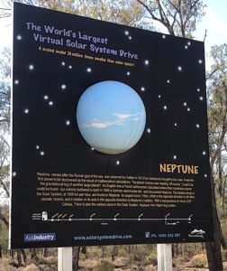
Narrabri is a town along the Newell Highway and the start of the solar system drive. This route has the world’s largest virtual solar system drive. It is a scaled model 38 million times smaller than the real thing. Rest stops along the way have massive information boards each with a scaled-down-to-size globe of the planet it depicts. The drive between rest stops is the scaled distance between these planets. It’s a cool way to even try to grasp the size of the universe, even so, it is beyond imagination.
Sand Caves
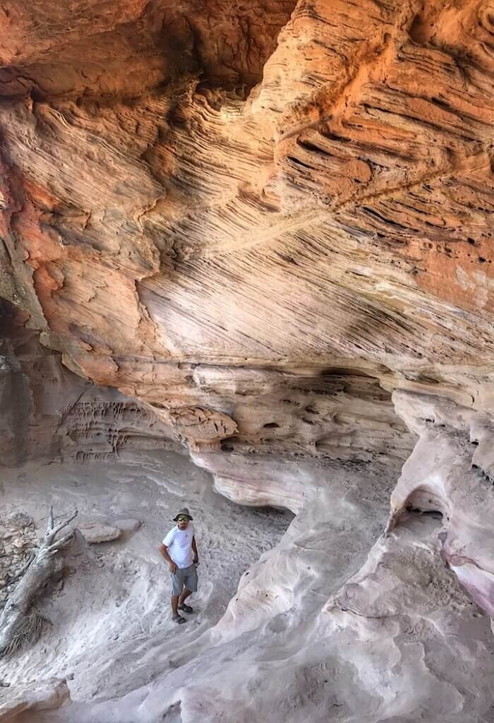
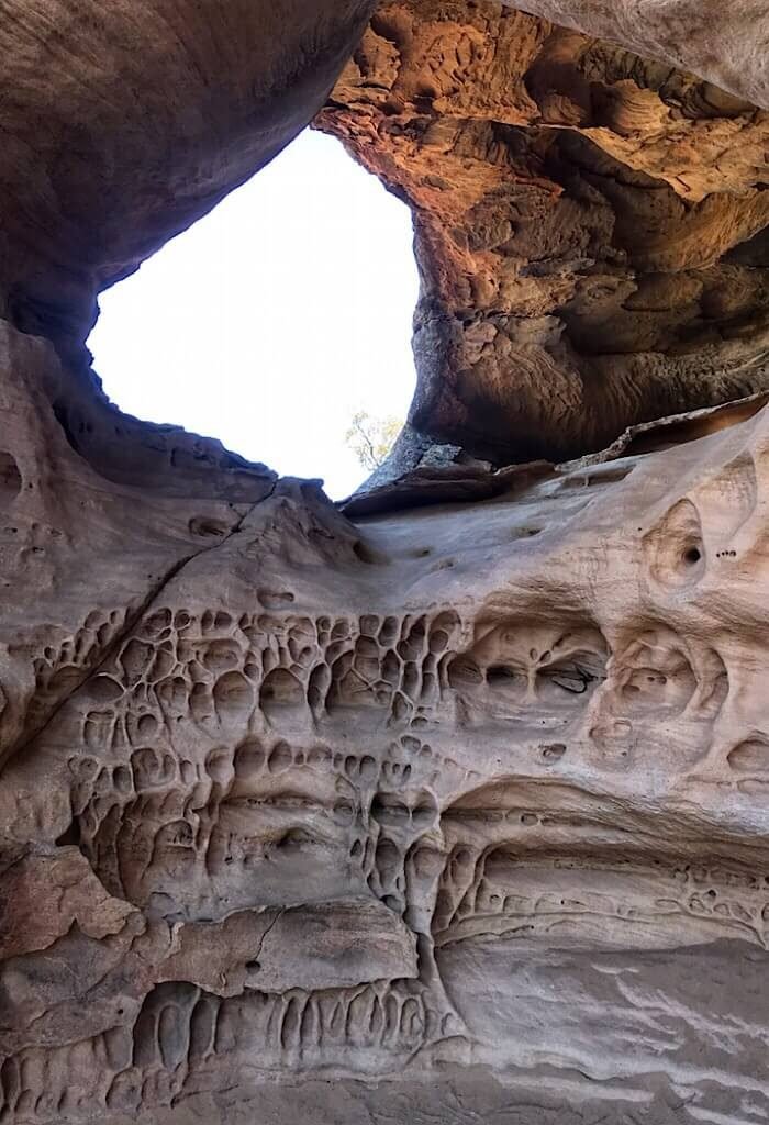
After stopping to see Uranus while traveling through the Pilliga Nature Reserve we took a left on a little corrugated dirt road and bumped our way into a tiny parking area just a few kilometers. We were here to see the sandstone caves.
These caves were used by the Aboriginal people and still bear marks of Aboriginal rock engravings. We wound around the rocks and in and out of a few caves. It is a nice little stop along the solar system way. The turn for the caves is not marked on the road so we relied on our GPS to help us find the turn.
Dark Skies
I was looking forward to reaching the Warrumbungle National Park. It is a dark skies park and the ‘Astronomy Capital of Australia.’ It has been given the gold star rating for the absence of light pollution making the milky way an astronomical wonder for the naked eye.
Seeing stars on a moonless night in the desert in a dark sky region is an experience like no other. Far from cities and light pollution, the darkness is tangible. We may not have had the advantage of telescopes as we did in the Elqui dark sky region of Chile, but the sky still feels closer. In every direction, brilliant lights speak of a vast universe filled with objects that create artwork in the midnight sky. It is a painting beyond imagination and still beyond our understanding.
The Warrumbungle park was created by volcanic activity long ago. The activity created barren spires, cliffs, and unique rock formations. All these formations and peaks abruptly stop as it sits on the edge of the western plains of Australia.
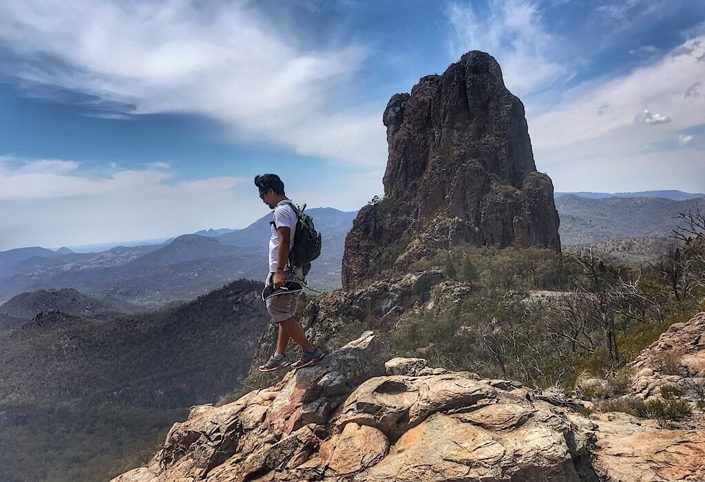
The Breadknife Trail
I was so intent on getting a picture of the kangaroo ahead of us on the trail that I didn’t see it. I crept forward quietly completely focused on the Kangaroo.
A movement down on my left caught my eye just as its black scaly head reared up right next to my calf. I jumped, and I may or may not have screeched, as it lunged and then I ran as it slithered away.
We were on the Breaknife Trail in Warrumbungle National Park. This trail winds up and down through the rocky terrain and round and up to a rock formation called The Breadknife.
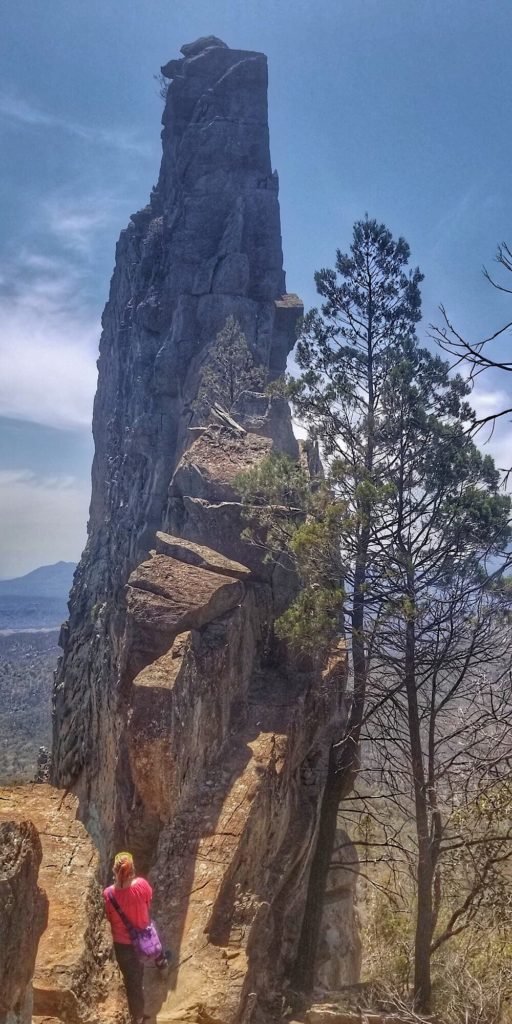
The Breadknife is a volcanic dike that looks like a massive mountain top when viewed from the side, but looking straight on it is a spectacular, knife-edge rock formation sticking up from the valley. The “knife” stands 100 meters high and 600 meters long but is only 4 meters wide.
There are multiple stream crossings along the Breadknife Trail, all of them dry. We brought two large water bottles plus an extra jug of water. We drank every drop and were still parched when we got back to Lil’ Beaut. The heat and dryness of the air sapped our energy, but the beauty made us glad that we made the effort.
The f*#$ing d*#^head
We stopped in Dubbo to refill our food supplies and found a nice park where Trin could change the oil on the manual gearbox. It was a nice spot and we decided to park there overnight.
We stood outside Lil’ Beaut in the cooling night air when three cars approached. The first car revved its engine and then headed straight for us. I stood there and pulled up my phone pointing it at him with video on record.
He did a donut only a few feet from us and Lil’ Beaut and then sped off. The next truck in line then came towards us slowly yelling something unintelligible out the window.
“What was that?” I asked still filming.
“He’s a fucking dickhead, isn’t he,” he repeated. It sounded more like he’s a foken deekheed, eenie.
I chuckled.
“We will try to get his license plate, take care mate,” they said and drove away.
The third car followed suit. I’m pretty sure they were all friends. It was quiet for a little while.
Then one truck kept circling around every few minutes. We wrote down his license plate number.
After multiple other cars and trucks came down the road circled and then left we came to the realization that the spot was probably a good make-out point and so we decided to move. Just a kilometer down the road was another parking area. This one already had one van parked for the night. We pulled up a few spots away and had no issues the rest of the night.
Falling Asleep to Rain
Glad to be headed back out of town we followed the Newell highway to Ponto Falls. Now that we are approaching the south and closer to the coast there is more water again. The Macquarie River flowed gently by our campsite.
The smell of desert rain took me back to my childhood in West Texas. On the rare occasion when the rain would come, the first drops would evaporate as soon as they hit the parched ground. They emitted an earthy smell unique to the soil for which moisture is a stranger. It smells like heat dissipating. That night we fell asleep to the pitter-patter of a few drops that by morning only made dust marks on the outside of our home.
We are truly loving life in a bus and smile whenever we finish hiking a trail and come back to Lil’ Beaut again. I’ve never dreamt that opportunity and the choices we made would bring us here.


I am so enjoying your travels in Australia. The pictures are absolutely gorgeous!
Thank you Jackie 🙂
I love following your travels! Every post makes me excited for the next and just a little jealous I’m not there too.
Thank you. I hope you’re little one is feeling better now
Another great post. Looks like one could spend a few years RVing in Australia!
Yes, we are beginning to believe that and considering applying for a second year.
What a beautiful place, I love to visit these kind of of rocky places. Last month I have visited the rocky mountain which looks kind of similar to this, and it was so beautiful.
Yes, it is beautiful. One of the many reasons we fell in love with Australian. There are so many beautiful places around the world.
Good to visit here.
Wow thanks for posting this informative and interesting article this is very nice and I will share this with my all friends and once again thankyou and keep it up.
Thanks for sharing
Extremely excited about this great article that is educational and helpful Outstanding work. I really enjoy to read your blog. I was taking coursework writing service then I was searching blog suddenly I see your blog I like it.
In the face of drought, New South Wales grapples with water scarcity, impacting its iconic landscapes like the Weeping Rocks. Community resilience shines amidst challenges, urging innovative solutions for sustainability.