
Hiking in the Caucasus Mountains is both breathtaking and challenging. We set out on the famous Mestia to Ushguli trail in Georgia, but completed a three-day version ending in Khalde instead. With glaciers, ancient Svan towers, and remote villages along the way, this trek is one of the most unforgettable journeys in Svaneti. In this post, you’ll find our videos from each day on the trail, along with personal reflections — from battling a sore knee to embracing the motto “do hard things.”
As we planned our trek in the Caucasus Mountains, I doubted my ability to complete the hike. I’m pretty sure I have a meniscus tear in one knee, which makes downhill especially difficult. Still, the phrase “Do hard things” kept circling in my mind, and I was determined to do this hike.
Generally, I hate being on video. However, Trin is the videographer and I’m the photographer, so here I am, swollen, hot, and sweaty. At first, we filmed this only for a small group of friends, so it’s raw, candid, and sometimes awkward.
Arriving in Mestia
The journey began with a marshrutka, one of those small vans where they stuff in as many people as possible, from Zugdidi to Mestia. It took somewhere between four to six hours (we’ve already blocked it from memory) along winding mountain roads, some partly washed out from landslides.
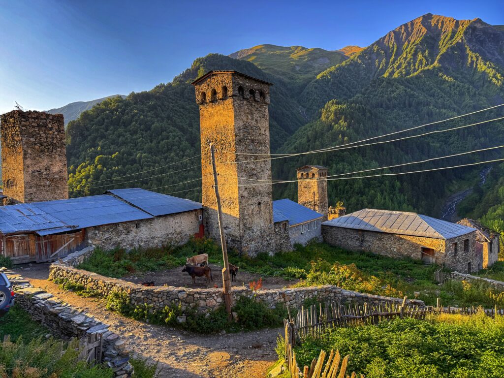
Towering mountains and glaciers surround Mestia, and the region is dotted with Svan towers, defensive stone structures built between the 9th and 12th centuries. Day 1’s video starts with me walking toward one of these towers.
Our guesthouse in Mestia was right next to the family’s own tower. Our host informed us that it has belonged to his family for over 1,000 years. That’s cool, but also an incredible responsibility! As we chatted with our host, their cow wandered home on its own for dinner. He explained that every morning, cows are released to graze freely in the fields and mountains, and each evening they return to their own doorsteps for milking, like clockwork. He smiled and said: “They are all living their best lives.”
The “Blessed Battalion” I mention in Day 1 is our small prayer group that meets weekly over video calls. They’re dear friends, and these videos were originally meant only for them. So why share them publicly now? Because once again, “do hard things” keeps echoing in my head.
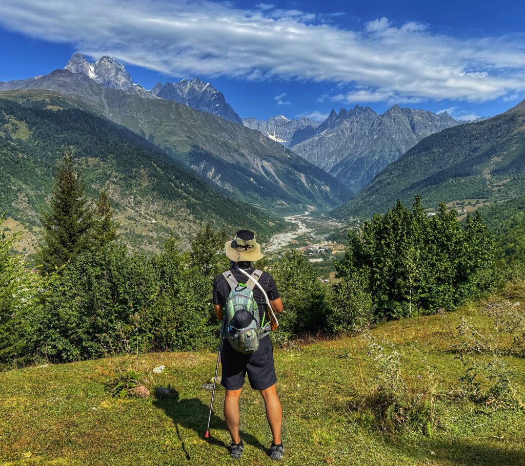
Day 1: Mestia to Zhabeshi
Distance: 9.8 miles (15.8 km)
Elevation Gain: 2,782 feet (848 m)
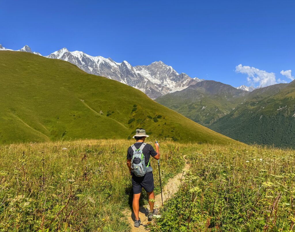
From our lodging in Mestia, we set out toward Zhabeshi. Along the way, we chose the high road above Lakhiri for sweeping views of the valley below. The trail gave us steep climbs, rugged mountain views, and passages through small stone villages that have existed before the little ice age.
The stick that I’m using helps distribute the weight of my pack across my shoulders and keeps the thin straps from digging in. The attached towel is great for dipping in cold water and laying across my neck to keep cool. It also helps block the sun from the back of my neck.
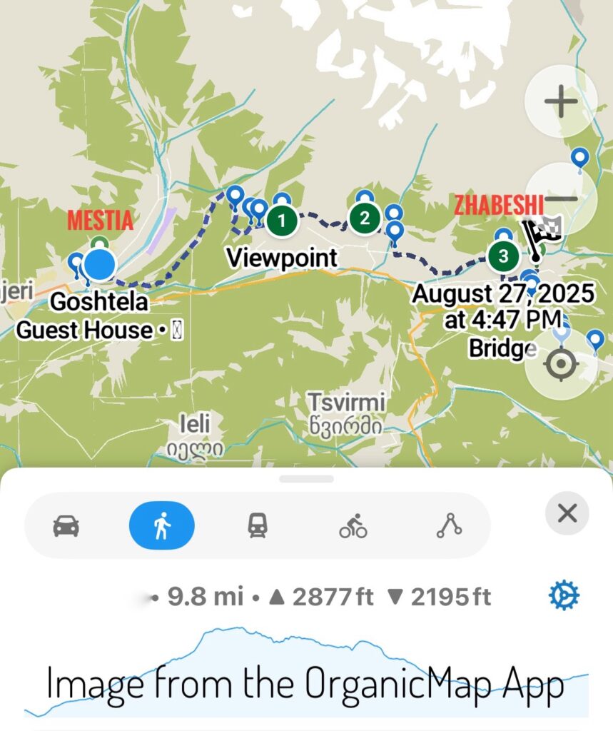
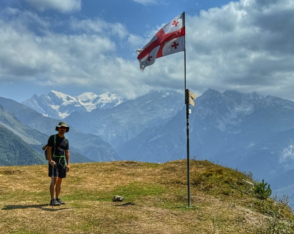
Note to trekkers: We highly recommend Organic Maps for offline navigation. Watch out for the left path just after the Kaskari mountain pass (just before the circled 1 on the map above) that will keep you on the high road. We missed it and had to climb back up. The lower path will still get you to Zhabeshi, but the views are better on the higher path.
Day 2: Zhabeshi to Adishi
Distance: 6.2 miles (10 km)
Elevation Gain: 3,192 feet (973 m)
On our second day, we hiked from Zhabeshi to the tiny, remote village of Adishi — a place so small it can be captured in a single camera frame. The villagers (and their horses) would help us the following day when it came time to cross the freezing glacier river.
Yes, we wore the same clothes every day, but notice how small our packs are compared to most hikers we met. Carrying only the bare necessities made the elevation gains so much easier to manage. Having a *Sawyer water filter also reduced the amount of water we had to carry making our packs even lighter.
*Affiliate link, so we may earn a commission if you use this link. This has been our trusted filter for almost a decade now and we’ve never gotten sick from water.
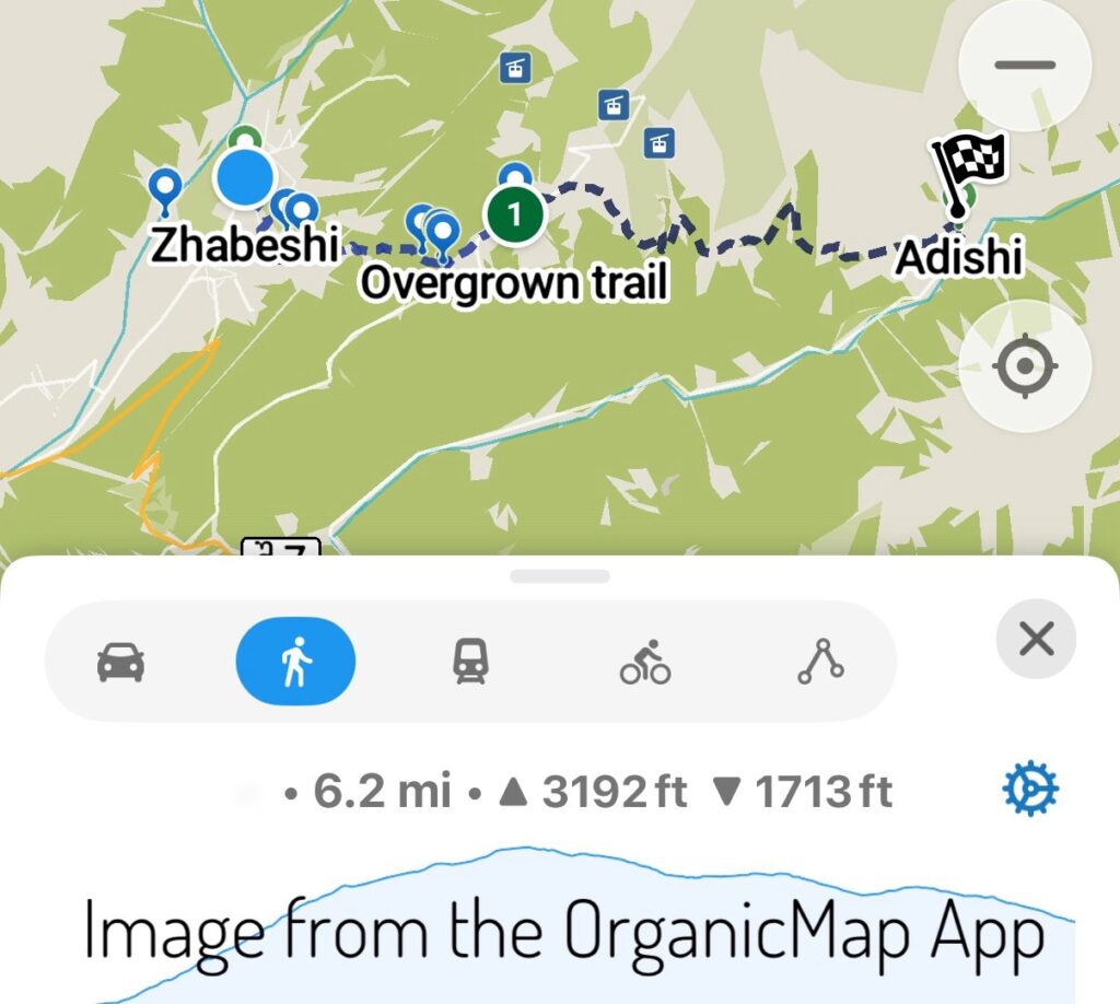
Note to trekkers: Just before the ski station, several trail options appear on the map. They all lead to the same place and are equally overgrown. Push through the bushes — it’s a short stretch — and you’ll be there. Everyone at the café at the top complained about this section, just pick one and go.
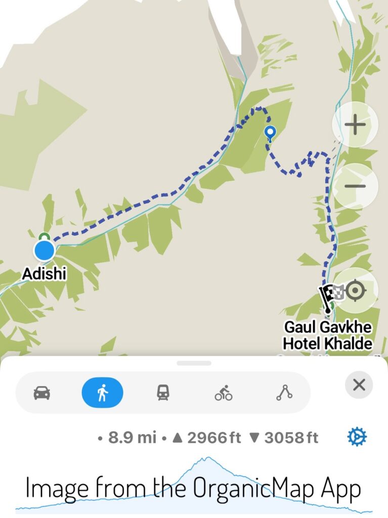
Day 3: Adishi to Khalde
Distance: 8.9 miles (14.3 km)
Elevation Gain: 2,966 feet (904 m)
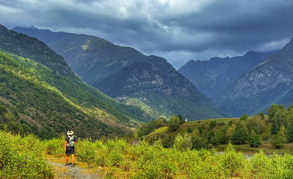
On the third day, we followed the glacier river up the valley from Adishi to its headwaters, where the water spills directly from the ice. We pushed our pace a little that morning since the river grows stronger as the day warms. By mid-afternoon it is impassable. Under a cloudless sky, we aimed to cross before it became too dangerous.
Villagers waited at the crossing, offering horse passage across the icy torrent for a fee. The horses carried us most of the way, but left one smaller tributary for us to cross on foot. Even barefooting a short stretch left our feet numb in seconds from the glacial water.
From there, the trail climbed over Chkhutnieri Pass, rewarding us with spectacular views of the glaciers and valleys.
That night we chose to stay in Khalde instead of continuing to Kala. From Khalde toward Ushguli, the path follows a dirt road — said to be the least scenic section of the four-day hike — so we decided to skip it. A fellow hiker we befriended, however, doubled back the next morning to tackle the steeper, more challenging route over the pass to Ushguli.
Svan Towers
Svan towers stood in small villages along the way. These stone structures once served as fortifications and family dwellings during times of conflict. They were also shelter from avalanches and landslides. Today, they remain symbols of Svaneti’s resilience and identity.
Do Hard Things
Whether you’re planning your own Mestia to Ushguli trek or just curious about life on the trail, we hope these videos give you both inspiration and a real, unfiltered glimpse into the journey. Sometimes the hardest things turn out to be the most meaningful.
I may have doubted myself at the start, but finishing the trek reminded me why it’s worth doing hard things. What difficult thing will you do this week?
Wow. A level of commitment I would find difficult, if not impossible. Bonnie the pain from your torn meniscus must be very challenging to keep going.
The pain isn’t constant all the time so it’s definitely manageable. It’s just that it gives out at unexpected times and is very sore after long downhill’s. I’m surprised how well the knee did, but I know my prayer ground was with me every day as well.
Wow!!! I’m so impressed by both of you. I’m sitting in my reclining bed thinking I couldn’t have completed this trek. You guys are amazing! Way to do hard things.
Thank you Amber! But I think that reclining bed is deserved after all the hard work homesteading! Hard things are so rewarding.