Everyone we met that had been to Torres del Paine raved about it. The trek had been on their bucket list for years. It is so popular that campgrounds in the park sell out several months in advance.
We were in North Brazil having just left one of the most beautiful places we had seen yet when we made our reservations for Torres del Paine (side note: Paine is pronounced as “pie” as in blueberry pie, plus “neh”). It was August and we booked our campsites for December. Even then the campgrounds were almost full and we had to choose our dates based on what was available. The Refugio Grey campsites were all booked for December.
We chose the month of December because it is the start of the summer and just before peak season. We were hoping for better weather while still avoiding the worst of the crowds.
Torres del Paine Hiking options
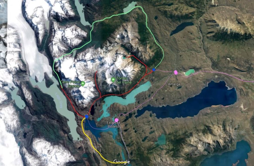
The W Trek
The W trek shown in red above is a popular route taking hikers up three valleys in Torres del Paine. Hikers can start at either end (see the blue dots). The bus stops at the two purple dots (and also at the end of the yellow trail) on the map. On the west end a catamaran awaits to take hikers to the Paine Grande campground which is the starting point for the hike to Refugio Grey. On the east end a shuttle can take hikers to the Torres Central campground at the start of the hike up to the famed towers. My favorite detailed map of the W trek can be found on Wikiloc.
The W trek is approximately 55 miles (88 kilometers) of hiking, a bit more if you extend past Glacier Grey to see the hanging bridges (which I recommend). With all of the ups and downs this trail will climb about 10,000 feet (3,000 meters) and back down about the same, but the trail doesn’t go above 3,000 feet (900 meters) elevation so no need to worry about elevation sickness.
You can start from the
I was happy with our decision. Our second day was a long hike but with only our day pack. I’m glad we didn’t have to lug our backpack through it.
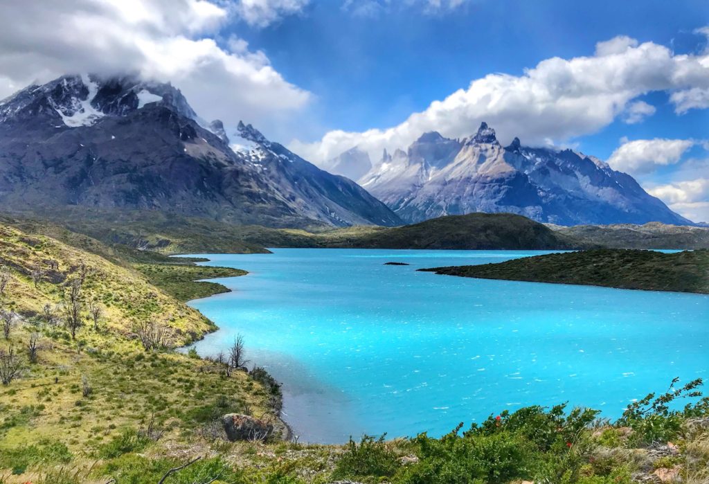
Other Trek Options
The O circuit is the W trek plus an extension that loops hikers around the back of Torres del Paine, forming a sort of O shape with butt cheeks. In total it’s about 80 miles (128 kilometers).
There is also the Q trail that adds about 10 kilometers. It is the little yellow tail shown on the map above and includes some spectacular views of the park.
Day hikes are also an option if you have limited time. The Torres del Paine towers are the eponymous main attraction of the park. A day hike from the Central campground to the towers would be 6.25 miles (10 km) one way. Other treks can also be done via day hikes starting at either end but you may want to get a car so that you can start early in the morning before the buses arrive.
How to Prepare
Train: Hike as much as you can in the upcoming weeks prior to the trek. I created a training plan for us on a spreadsheet. Then got sick in Valparaiso and was in bed three days with a fever pretty much annihilating the start of the plan. Anxious to get started I was back on the trails again when we got to Bariloche but didn’t have the energy to make it up to Refugio Frey (made it up to Refugio Petricek 8 kilometers in, then had to turn around). It shook my confidence in being able to complete 88 km on the W trek only a month away.
El Chalten is an excellent training region with stunning landscape. It’s also a great place to test your gear to make sure you will be warm enough. Hiking the trails here built up our confidence and filled our vision with beautiful landscapes.
Pack layers: along with a rain/wind shell. A warm coat and a zero-rated sleeping bag are a must especially at night. It gets cold in the park at any time of year. Hikers need to be prepared for all seasons of weather. At any day, hikers may experience all seasons.
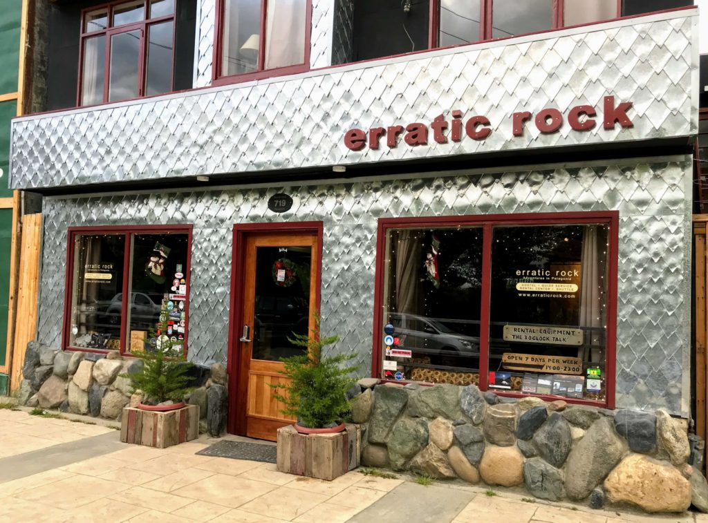
Educate: As soon as you arrive in Puerto Natales stop in at Erratic Rock for the 3 o’clock talk. It’s entertaining and very informative. You can also rent your gear from them. Even if you are not going to a multi-day hike in the park the 3 o’clock talk is worth the time. It is free and you can also pick up free stuff for your hike in the bin where other hikers leave behind their extra gear.
Visit the Erratic Rock website to find out about their rates for gear rental. You can also find information about their guided programs and expeditions that they offer. They’re a hostel too, with competitive rates. The staff that we spoke to were trekkers and they knew what they were talking about.
Be ready to be uncomfortable at times, but know that the
What is it actually like?
We arrived in Puerto Natales late in the evening a few days before our trek would begin. As we walked along the waterfront, we shivered in the cold wind even with most of our layers on. I wondered with dread if we would be shivering for five days and four nights on the W Trek.
Our gear would have to be sufficient for this trek so that we would not freeze at night like the last horrible night in Bolivia or even the cold night by the abyss of a volcano in Nicaragua. I really hate being cold.
Renting Gear
Our first task was to find the best place to rent gear. We needed a tent, sleeping bags, sleeping pads, and a camp stove. There’s a lot of shops that rent out camping gear in Puerto Natales and we compared the gear and prices of most shops that were open. We chose Erratic Rock for their competitive prices and excellent service. I really appreciate that they give free daily talks about Torres del Paine. At least stop by to say hi and tell them we sent you, the staff is pretty cool to talk to.
We attended their
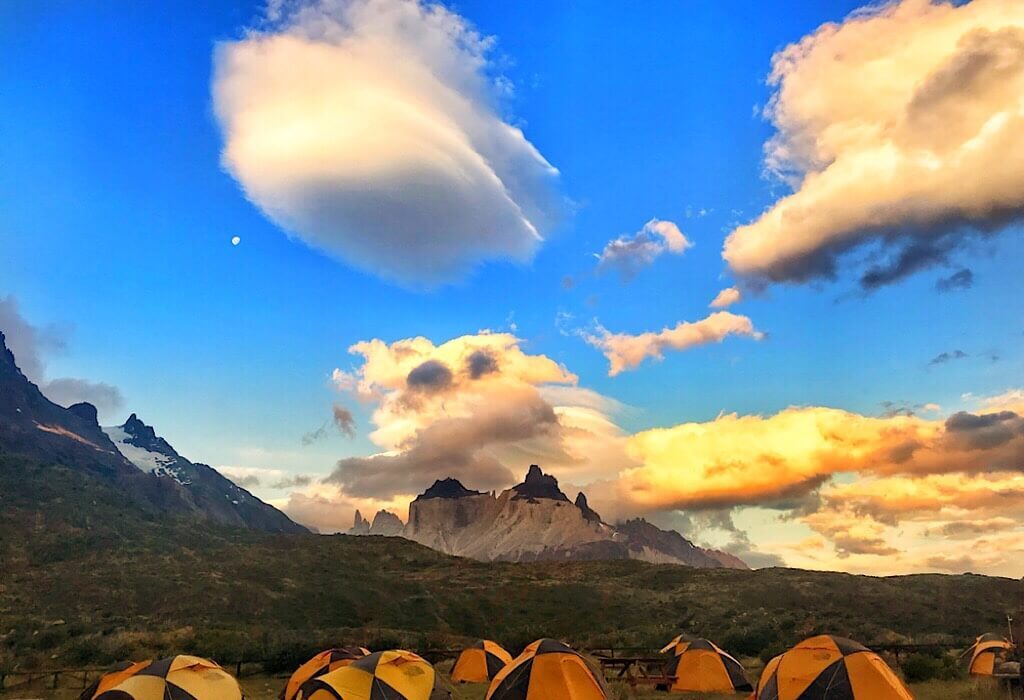
“The trails are well marked in Torres del Paine, you can’t possibly get lost in Torres del Paine,” said Rustyn, the co-owner of
“Every year someone gets lost in Torres del Paine,” he said as he set his glass back down.
Things happen every year. Be smart, stay on the trail and be prepared for high winds and driving rain or snow. I also suggest getting the
Day 1: Getting to the Park
Early on the morning of Dec 17th we grabbed our bags having picked up our gear the night before and walked to the bus station. It was cold and we walked there excited but with a bit of dread. We wanted to do this trail, we would do this trail even if we had to push ourselves. We were excited for the experience and ready for the cold and driving rain looming ahead of us to be over.

The bus ride to the park entrance from Puerto Natales is two hours. We caught the 7 AM bus. At the
From the park

Setting up Camp
We arrived at the Paine Grande campground at around noon. There is also a hotel where guests can stay. The hotels are expensive and to us would kind of ruin the experience, we came to experience the wilderness and all nature had to offer.
We set up the tent and staked it down as best we could, hoping it would not get blown away. This was our destination for day 1. Most hikers proceed to Refugio Grey with the full weight of their gear. Since we had time we headed down the Q leg of the trail to catch a few viewpoints before embarking on the W trek early the next morning. The feature image of this post was taken from one of those viewpoints.
The wind during our first night was strong and we wondered if the tent would hold but we stayed warm and dry.
Day 2: Grey Glacier
Stats: 27 km, cold, hot, high winds, beautiful views and hanging bridges

On Day 2 we hike to Grey Glacier and back. We left our tent set up and our packs inside it since this would be an out and back day. With just our day pack, rain coat and jackets on the ready, we headed out at around 7 AM. This would be the first leg of the W trek starting from the west
The trail started out nice and easy as we hiked up north towards Refugio Grey. The morning was cool and foggy. It that felt like spring bringing on new life. Once we emerged from the valley and reached the first pass viewpoint, hurricane force winds greeted us making even the flat terrain feel like a steep incline.
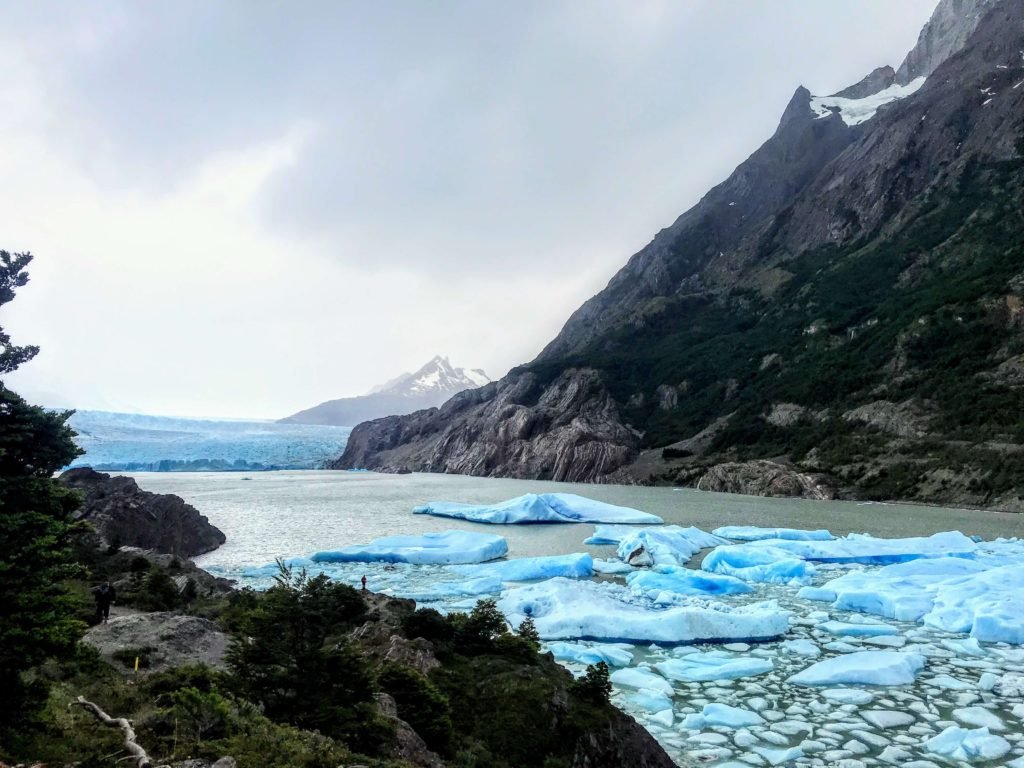
From here we had a nearly constant view of Lago Grey with the occasional iceberg stuck near the edge of the water, and a distant view of the glacier. At some point the trail descends out of the path of the roaring 50s winds. We descended and then ascended multiple times, getting in and out of the wind’s path but were always greeted by beautiful views of Lago Grey on our way to the glacier that awaited us.
Hanging Bridges
Glacier Grey currently stands far back from the Glacier Grey ranger station. Our Airbnb host in Punta Arenas told us of the days when she was younger and the glacier butted up against the land near the ranger station. She said she could touch it from that lookout. Standing on that same spot, we could only see it from a distance across the lake.
To see it better and also the experience the famous hanging bridges we hiked further up a couple of kilometers. What is it about hanging bridges that fascinate me so much? Maybe it’s the noble purpose of connecting two places, or the precarious nature of its construction, the way it is suspended usually over a frightening chasm, the way it undulates when you walk on it.

Yet I cannot help but walk on them, usually white-knuckle grabbing the handholds, never doubting that the next plank I set my foot on will snap into splinters and I would plummet to a spectacular death.
This bridge was well constructed. I grabbed the handholds on either side as I walked. It bounced happily and I half-expected to see Trinity jumping up and down behind me. But he wasn’t, he’s not even on the bridge. I looked over the handhold and down into the ravine, into the tiny river running through it, for only a few seconds and then moved on.
As we made our way back to Paine Grande camp the sun greeted us

On our second night, the winds were even stronger and the spine of the tent was pushed to our faces testing its limits. It held and once again we stayed dry and comfortable.
Day 3: Valle Francés (French Valley)
Rustyn warned us about the weather conditions in Valle Frances, our destination for day two. Winds pick up speed as they are squeezed through this narrowing valley and are often cooled as they pass over the massive glacier on the west side of the valley. He warned us about the sideways driving rain that shoots out of this valley. We were expecting the worst.
Would our clothing and coats be drenched never to dry and leave us shivering the rest of the way? I’ll leave that tale for next week as this post is getting long.
What will you challenge yourself to do this week?

I don’t know if I would challenge myself the way that you guys have, but I believe that it is always good to step out of our comfort zone once in a while. How can you grow unless you do?
I agree, it’s a great way to grow. We all have different directions and ways to challenge ourselves and learn. It’s all about walking forward.
Oh my goodness, that sounds like the perfect next challenge after the Inca Trail! And your photos are absolutely STUNNING. We are planning a trip to Patagonia soon. But I’ll need to convince my better half, who has sworn he will never sleep on the ground again 🙂 Thank you for paving the way for us.
You can stay in cabins along the Torres del Paine trail and still experience all the beauty. You did the Inca, I’m sure you could do this one too 🙂
Looks like you had a wonderful trip! Torres del Paine is high on my bucket list; I appreciate the informative report (and photos! Wow.)
Jill you could crush this trail and I think you would really enjoy all the views. I’d love to see you write about it as well.
I have wanted to Visit Patagonia ever since reading Bruce Chatwin’s famous book some years ago.
This is amping up that desire some what!
Your photos are amazing and even the description of your preparation / hiking training sounds fairly full on, let alone the actual experience of hiking Torres del Paine.
I am off to read some more of your posts…
Shaun
So glad to have you here Shaun! I hope someday you make it up to Patagonia. Maybe later this year I’ll see you in Australia:)